Thanks to the alternation of stretches rich in vegetation and rocky ridges and overhanging walls, in Arenzano it is possible to practice climbing, trying out some easy rope pulls. Rock climbing walls excellent for learning to climb, with a splendid view of the sea into the Beigua Park.
From Arenzano, take the Aurelia to Cogoleto, turn right to the Val Lerone industrial area and continue towards Argentea agritourism. Park the car and walk along a grassy track that goes up to the right (way marker ▲). It immediately climbs up with a few bends, then goes around a wood and, leaving the path to Monte Argentea on the right (way marker ☆), enters the Rio di Lerca valley. Continue with a steady climb, until, before the dirt track begins to descend, you leave this to take a nice mule track on the right (always follow way marker ▲), which continues to climb through woods and stony ground. After the first stream, the path makes another steep climb and then reaches the bed of the small Rio Cinè, now in sight of the “Cresta delle Segàge” (0.50 h). After crossing the stream, you leave the mule track to begin the steep grassy slope. Following the precious stone cairns and the discontinuous traces of passage, you climb up the rugged valley (almost a gully) between the “Cresta delle Segàge” (on the left) and the “Costa della Botte “(on the right), both bristling with towers and spikes rocky. The climb is really steep, but the track helps: after passing a small stony ground, you go up to the left of a rock almost to the head of the valley. Go up a grassy ramp to the right towards a slab bordered by two long dihedrals; without reaching the base of the slab, turn right on a comfortable grassy ledge. Follow the ledge to the right for a few meters, up to the foot of a rocky spur on which you can recognize the bolts (start at a small rocky cavity with belay cord h 0,40 from Rio Cinè).
Total time 5,00h of which 2 hours of climbing.
Difficulty AD (III + one step IV) great for learning to climb, beautiful sea view.
Altitude: 650 m
Altitude approach: 500 m
Climbing development: 160 m
Maximum grade 4
Obligatory difficulty 4
Starting point Campo
Follow the easy north-east ridge to Monte Argentèa, then descend a steep grassy slope to the path below (way marker ☆). Follow it to the right, downhill. You reach a crossroads (Guà dell'Omü): go down to the left until you cross the "Engineer's Path". Follow it for about 200 m to the right, then take again a track marked ☆ which descends sharply in the steep pine forest. You come out on the cart track, at the point where it enters the valley of the Rio di Lerca: going down the last hairpin bends, you will soon return to Campo (1.15 h from the top).
Source: gulliver.it
From the Genova-Ventimiglia motorway, turn right and, after about 300 m, turn right again, after passing the hospital you reach Terralba. Here you take Via Pecorara on the left (immediately after a pharmacy) which climbs steeply to the north.
At a crossroads, go uphill to the right, following the signs for “Centro ornitologico - case Vaccà” up to Pian del Curlo where you can leave your car.
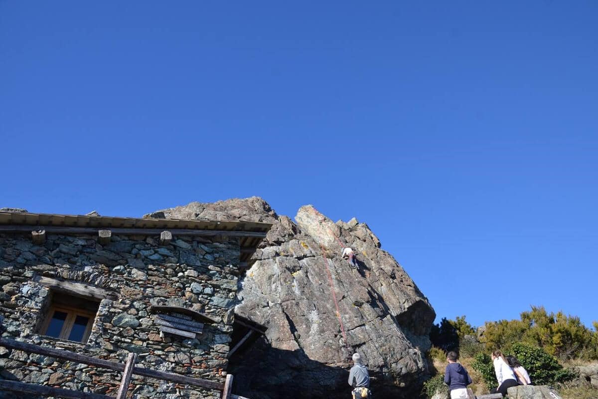
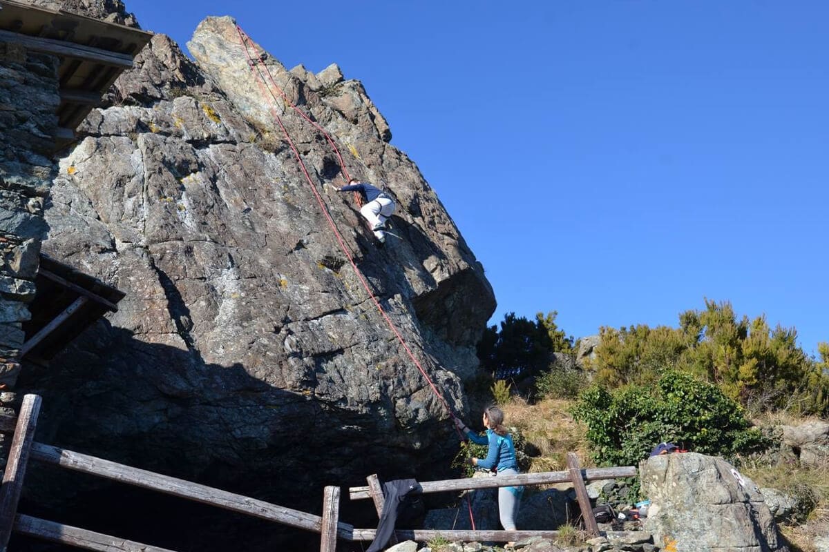
From here, take the uphill cart track, pass Case Vacca and continue on the path to the right (way marker two red stamps); it reaches the horizontal path (way marker A red). In 10 minutes, when you reach the top of the ridge, you can see the refuge and the climbing area with the sea underneath. Total time 30-40'.
Climbing area, recently equipped by C.A.I. Ligurian, it is ideal for climbing and rope exercises. A small alpine refuge is at the base of the wall. Climbing routes of medium difficulty. The routes are all with the maximum grade given by one or two passes, the rest on the fourth.
Source: gulliver.it


From the Genova-Ventimiglia motorway, turn right and, after about 300 m, turn right again, after passing the hospital you reach Terralba. Here you take Via Pecorara on the left (immediately after a pharmacy) which climbs steeply to the north.
At a crossroads, go uphill to the right, following the signs for “Centro Ornitologico - case Vaccà” up to Pian del Curlo where you can leave your car.
From here, take the uphill cart track, pass Case Vacca and continue on the path to the right (way marker two red stamps); it reaches the horizontal path (way marker A red). In 10 minutes, when you reach the top of the ridge, you can see the refuge and the climbing area with the sea underneath.
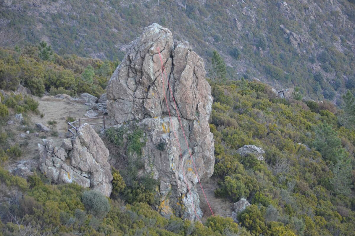
Beyond the Scarpeggin, the track follows the head of a wide valley, then you leave on the left the track directed to Passo della Gavetta (way marker V), to continue on path A. Passing under the high voltage pylon, you reach a small ridge, where the start of the route is located near a rocky pillar, indicated by a large stone marker on the right and a bolt on the plate on the left (h 1.15 from Curlo).
Almost all the shots can be safely taken in preserves, given the relative ease of passing.
Follow the path marked “●●” to the clearly visible Passo della Gavetta (0.15 h from the top). Following the path marked with the "V" to the left, you return to the path "A" and, through the alpine refuge Scarpeggìn, back to Agueta (0.40 h from the pass).
Source: gambeinspalla.org
• Walking from Arenzano through Pian del Curlo (292 m) and Passo della Gava, with the path marked with 3 red stamps you reach the alpine refuge of the Fasciun spring (973 m.). From the small building, heading west, follow the path (way marker 3 point red) on the stony ground towards Collettassa.
• By car from Arenzano, you reach the Turchino pass and take the SP73 provincial road towards the Faiallo pass. Close to the hotel "La Nuvola sul Mare" begins the path of the Alta Via dei Monti Liguri. Following the markers you arrive at the Vaccaria pass, continue south / west on the wide panoramic ridge. Once you reach the Cima Pian di Lerca, where the Argentea refuge stands, there are two possibilities to reach the low rock:
1) towards the south you descend to a hollow at an altitude of 940 (Collettassa), towards the east the path (3 red stamps) leads to the stony ground.
2) it descends to the source of the Fasciun (alpine refuge), from which, towards the west, you follow the path (3 red stamps) that crosses the stony ground towards Collettassa.
Beautiful athletic and panoramic climbing with rocks, anchors and bolted routes.
Source: gulliver.it
Superb environment, splendid panorama.
Due to the variety of routes this wall is suitable for everyone, beginners and experts.
The various sectors allow climbing throughout the year. In summer, the late afternoon is preferable.
N. Routes: 27
Difficulty: 3a / 7b
Height: 100 mt.
Source: falesia.it
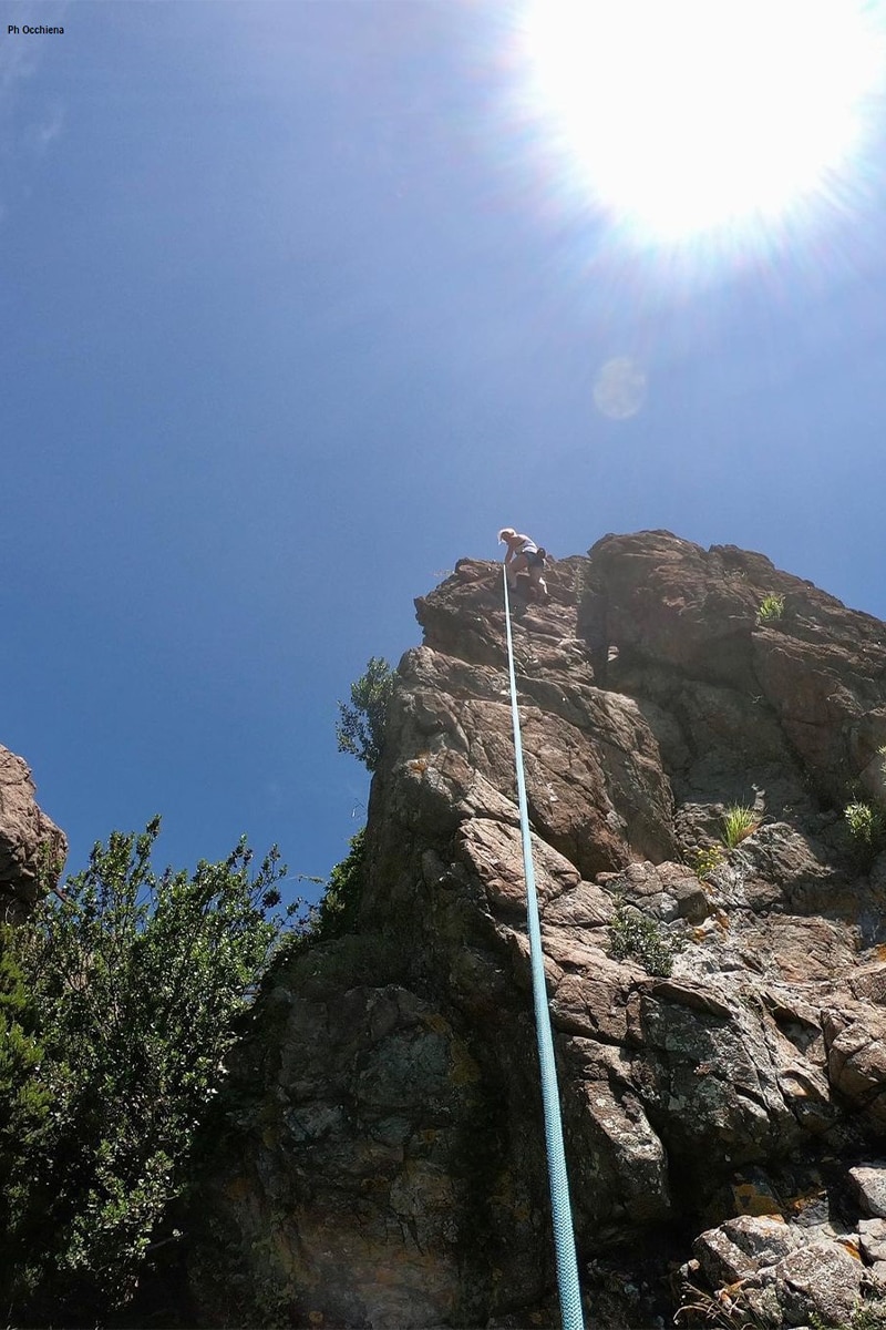
Nice climb, easy but very interesting and panoramic Passes of II, III, IV and IV+ degree, with exposed sections and panoramic views of the wild Vallone dei Guadi, where the river falls with spectacular waterfalls. The passages are largely not required, but in the upper part of the crest there is a certain elegance of lines. The rock is almost everywhere good. the section of IV ° / IV ° + is easily bypassed.
Climbing time 2.00 h from the start.
Like almost all itineraries of this type, frequent in the Beigua Group, the difficulties vary greatly depending on the ascent lines chosen, being almost never the obligatory route. In the first part of the street there are some small stone cairns.
Source: gambeinspalla.org